FRIEDENS-WEG | Bewegungs-Arena INNVIERTEL
5273 St. Veit im Innkreis

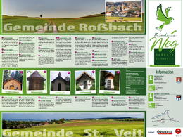
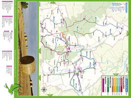
The communities of Roßbach and St. Veit im Innkreis have established a "Peace Trail". In the process, all known chapels, wayside and weather crosses were recorded and a hiking route was planned.
The path is not suitable for strollers or wheelchairs, as you often walk on forest paths, root paths, gravel paths and some side roads.
indication of parking spaces
There is a large car park in the center of town, which is well signposted. This is also the starting point of the path.
difficulty
The path is very demanding due to the length and the constant inclines.
refreshments
In the center of Roßbach there is a Nah & Frisch with a small snack bar. You can also visit the inn z'Grünau.
additional information
Sometimes you have to follow the signs for hiking trail no. 4, as this partly follows the same path.
📌 1. Roßbach Parish Church
The Roßbach parish church was first mentioned as the "castle chapel Roßbach" in 1140 and was registered as a parish from 1200. The parish church is dedicated to St. James, Gothic style, 3 naves and was rebuilt in the 17th century and later baroque. In 1967 the altar was completely removed during the renovation and only a people's altar was put up. During the last renovation in 1998, the church was completely renovated both inside and outside.
📌 2. Uberl/Anna Chapel
📌 3. Homecoming Forest Chapel
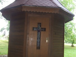
According to an old legend around 1850, there was an apparition of the Virgin Mary several times at the spot where the chapel stands today. Because of this event, farmer Bernroitner from Fraham had a small chapel built with the help of donations. The chapel has been enlarged and renovated several times. In 1944, two vacationers from the front made a promise to renovate the chapel out of gratitude if they returned healthy from World War II. Since 2005, the chapel has been a stage destination on the pilgrimage route to St. James.
📌 4. Way and weather cross Rödham
This cross has existed for 100 years. It has been renovated a few times. When the storm "Emma" destroyed the cross in 2008 and only the Lord remained, the Streif family rebuilt the cross in memory of their daughter Martina, who died in 2008. The cross was inaugurated in a ceremony in 2009.
📌 5. Barth Chapel Rödham
The chapel is over 100 years old. It has been renovated a few times. It was consecrated in honor of St. Anna, the patron saint of women who have recently given birth.
📌 6. Marterl Rodham
A man went out to work in the field with a scythe. He died when he was struck by lightning during a thunderstorm. A wayside shrine was erected to commemorate this man.
📌 7. Krottenthal Chapel
The chapel was built in 1990 by Josef Jodlbauer. He was suffering from nervous illness and because of his recovery he built this chapel.
📌 8. Schiefecker Chapel
Franz Mühlbacher, the builder of this chapel, had some serious accidents 20 years ago, which made it very difficult for him. Since he became completely healthy again, he wanted to build a chapel. Finally, in 2010, he built the Schiefecker chapel.
📌 9. Hofinger Chapel
The Hofinger chapel was originally a wooden chapel. Due to weather conditions, it has since been replaced by a cross. In 1990 the chapel was rebuilt with the help of many volunteers by the Ratzinger family (Hofinger). It was consecrated in 1992.
📌 10. Gschaidter Marterl
The history is unknown. In 1974, the Altheim working group for "townscape and home care" under chairman Prof. Lothar Bodingbauer started the campaign "Save the wayside shrines, wayside shrines and chapels" because they were in danger of disappearing as small monuments and thus being forgotten. Master builder Wolfgang Bodingbauer made the rough formwork for a multi-part wayside shrine. The "head" consists of 3 pictures: St. Leonhard, St. Florian and St. Maria, painted by the painter Walter Paulusberger from Kirchheim im Innkreis.
📌 11. wayside shrine in Parschalling
In 1874 Parschalling burned down and a carriage driver had a fatal accident during construction. The shrine that was put up as a reminder was very weathered. The Altheim road maintenance department renovated it in 1974 and fitted it with ceramic tiles. It is also a reminder of Karl Ortbauer zu Parschalling, who had a difficult life and hanged himself in 1973.
📌 12. Hofinger Column
There used to be a chapel at the "Hofinger zu Hofing" at a distance of 60 meters, which over time became so dilapidated that it had to be removed. Only the rest of a stone column remained was a clear distance from the courtyard, it can be assumed that the original chapel in Hofing marked the spot where a plague victim was buried.
📌 13. Hofbauer Chapel
The chapel is said to date from the time when there was still a castle in Grünau. The Feuchtinger family (Hofbauer) rebuilt the chapel in 1934. Years later the road was widened and the chapel was demolished. After the end of the road construction work, the road maintenance department set up the chapel new.
📌 14. Chapel Edt
📌 15. Chapel at the old vicarage
📌 16. Wooden cross in front of the old vicarage
📌 17. Pfarrermannkapelle/Bodingbauerkapelle/ Marienkapelle "Rosa mystica"
In 1997, the then owners of the "Pfarrermannsölde", Christine and Lothar Bodingbauer, had the chapel built as part of an unemployment project. The focal point of the interior of the chapel is the statue of the "Rosa mystica", the "Mysterious Rose".
The chapel is also adorned with images of saints and blessed, whose trusting appeal may grant help and strength in personal concerns.
📌 18. Hubertus Chapel Jaiding
At the end of the 1960s there was a major renovation of the church. The high altar, the two side altars and the sermon chair were demolished and stored in the old vicarage. When the old pastor's cook "Marie" was supposed to saw up the gilded altar parts, Josef Gottfried decided to buy the remaining parts of the church. In 2008 he and his family built the Hubertus chapel as a thank you for the health and creativity.
📌 19. Homeland Museum
The museum created by Josef Gottfried houses interesting and valuable treasures from days long past. It offers impressive insights into the often difficult everyday life of our ancestors. Tools, everyday objects, furniture, locks, chests, clocks and musical instruments can be found in the museum. Most items date from the 17th to 19th centuries.
📌 20. St. Nepomuk
Patron saint of bridges and against water hazards. Was built in 2010 as part of the Fraham bridge renovation.
📌 21. Aigner Chapel Fraham
In the 17th century Fraham was struck by the plague. Only two people survived - the "Schmied" and the "Aignersohn". As a thank you and as a reminder, the plague chapel was built by "Aignersohn". In the course of the conversion work on the course of the street, the chapel had to be demolished and rebuilt on the spot where it stands today.
📌 22. Schlossbauerkapelle
The origin of this chapel goes back to Wimhub Castle. The chapel is said to have been built in memory of the boy who climbed a tree and fell and was fatally injured. The chapel was renovated in 1996.
📌 23. Niederhauser stone cross
In the past, the deceased were carried directly from the homes of those affected to the church. Since very long distances often had to be covered, a stone cross (formerly a wooden cross) was set up at this point in order to gather new strength.
📌 24. Marterl pirate
📌 25. Memorial plaque Kirchensteig
There used to be a wooden cross with the "Lord" on it. Since it was already very weathered, it was rebuilt. After the cross was destroyed, today's wayside shrine was erected.
📌 26. Stumbling block
Franz Braumann (born 1908) was executed on July 5, 1944 for undermining the military force. A stumbling block was set to commemorate.
📌 27. St. Vitus War Memorial
The war memorial was erected to commemorate the fallen St. Veiters of the First and Second World Wars.
📌 28. Branch Church of St. Vitus
The Church of St. Veit is a small late Gothic parish church that is decorated with pretty four-thaler stucco. Of the rococo altars with beautiful paintings, the high altar with the altarpiece by Josef Brandstätter, the charming tabernacle and the pulpit, which was created around 1760 at the same time as the high altar, is particularly noteworthy. The statues of St. Barbara and St. Magdalene on the altar of the 17th-century mortuary chapel have a peasant appearance.
📌 29. Wooden Cross Marlupperberg
📌 30. Katzlberger Chapel Marlupp
Gerner Nani (known as G'Schlossbauer Nani) was seriously ill. Because of her recovery, she had the chapel built.
📌 31. Feichtinger chapel
It is a "thank you chapel" that was built in 1995 by Kreszenz and Manfred Feichtinger in front of their agricultural property in Pudexing. The occasion was the recovery of their son Josef after a serious accident.
📌 32. Marterl Pudexing
More tips along the route
You have a chance to "kneipp" at the St. Veiter brook or you can let yourself be pampered in the shady guest garden at the inn "Haiderwirt" in St. Veit im Innkreis.
Paths covering:
further information:
- Flatly
Details - hiking
- themed path
- Suitable for groups
- Suitable for teenagers
- Suitable for seniors
- Suitable for single travelers
- Suitable for families
- Suitable for friends
- Suitable for couples
- Spring
- Summer
- Autumn
- Early winter
Please get in touch for more information.
Nr. 31
5273 St. Veit im Innkreis
Phone +43 7723 6113
E-Mail gemeinde@st-veit-innkreis.at
Web www.st-veit-innkreis.at/
You can also visit us on
Facebook BlogVis-à-vis users
1. The tours presented for hiking, walking, biking and road biking, mountain biking, motorbiking, horseback riding, climbing, cross-country skiing, and going on skiing and snowshoe tours etc. are to be considered non-paid tour recommendations and only serve as non-binding information. We have no intention of concluding a contract with the users of this website. The utilisation of the data does not lead to the establishment of a contract with us.
The data may only be used for private use; any commercial use is prohibited. In particular, it is not permissible to offer the data on commercially run websites, file-sharing platforms etc. or to use it to develop commercial products. Downloading data does not imply that users are granted rights to the data concerned.
The tour recommendations posted were created with utmost care; nevertheless, we assume no liability for the correctness and completeness of the information.
We point out that neither the tour recommendations included on this website nor the associated data and information were posted by us, but rather by third parties (Art. 16 Austrian E-Commerce Act). We have no influence on whether the details provided (e.g. distance, level of difficulty, change in altitude, description etc.) are authentic, correct and complete. We do not review these third-party contents. For this reason, we assume no liability for the authenticity, correctness and completeness of the information.
Construction-related measures or other influences (e.g. landslides and similar occurrences) can lead to temporary or permanent changes in a route (e.g. loss of a bridge and similar occurrences). Such occurrences can lead to part of the route or the entire route becoming impassable.
The use of the data as well as undertaking (riding, walking, taking etc.) the recommended tours or using the network of paths occurs at users’ own risk and on their authority. In particular, users themselves are responsible for the choice of route, outdoor orientation, adherence to traffic rules, supplies and equipment for tours listed in Point 1 (e.g. bicycle etc.), wearing a helmet, estimating their own fitness, recognising dangers and maintaining an appropriate velocity. We exclude ourselves from any liability whatsoever for damages, in particular accidents, that occur whilst taking part in the recommended tours.
2.Some of the tours lead over roads with normal traffic conditions. Please observe that there is an increased risk which can be avoided by means of appropriate attention and proper estimation and implementation of one’s own abilities. For this reason, please travel a route that is unfamiliar to you slowly and with special care. Pay constant attention to potential dangers and always observe traffic. Do not leave the routes featured in descriptions.
The potential use of private roads, in particular forestry roads and agricultural transport roads, can be subject to legal restrictions, which must be observed and adhered to.
The normal traffic rules apply. Each user (e.g. biker, motorbiker) is responsible for adhering to these rules and maintaining his/her bike/vehicle and its equipment (lights, brakes etc.) in good working order. Each user is also responsible for ensuring that he/she rides at a velocity that is appropriate for the conditions and his/her skill level and for maintaining sufficient distance to the rider in front. We explicitly recommend adjusting velocity to correspond to the respective field of vision, wearing a helmet, using reflective clothing (or similar) and employing bicycle lights in line with regulations.
3.Each tour requires good physical fitness as well as detailed planning. We explicitly recommend only taking the tours in the case of optimal healthiness.
We recommend that you conclude an accident and liability insurance policy. Use an onboard computer that displays the respective kilometres travelled per day and is calibrated for the front wheel.
4.Special for mountain bikers – Fair-play rules:
Mountain biking is one of the most wonderful outdoor leisure-time activities. Whilst biking or on a mountain biking tour, mountains and lakes, meadows and cabins are re-discovered in new ways. A couple of rules for fair play in the forest help to avoid conflicts whilst mountain biking.
a.Pedestrians have the right of way: We are accommodating and friendly to pedestrians and hikers. Upon encountering these fellow travellers, we alert them by using the bicycle bell and slowly overtake them. We avoid paths with heavy pedestrian traffic altogether. Take nature into account: We do not leave refuse behind.
b.The braking distance should be half of the total distance visible: We ride at a controlled pace, are ready to brake and maintain a braking distance half as long as the total distance visible, especially in curves, because we always have to count on obstacles on the path. Damage to the path, stones, branches, wood piles, grazing livestock, cattle grids, barriers, tractor-type forestry machines and authorised vehicles pose dangers that we need to be ready for.
c.Don’t drink and drive!: Do not drink alcohol when mountain biking. Take care at stop-off points (dealing with bike racks, dirty shoes or clothing).
It is obligatory to provide first aid!
d.Marked routes, closed paths and blockades: Keep to the marked routes, observe the blockades and accept that these roads are primarily for agricultural and forestry use!
Blockades can often not be avoided and are in your own interest. Biking beyond the intended path and outside of opening times is punishable and turns us into illegal bikers.
e.We are guests in the forest and behave accordingly, including vis-à-vis forestry and hunting staff. Whilst mountain biking, mobile telephones and music players are forbidden! Biking requires your full attention.
f.Avoid unnecessary noise. Out of consideration to the animals living in the wild, we only bike during full daylight. As a principle, we always wear our helmet (even when riding uphill)! Don’t forget emergency supplies: We always have a repair set and bandages along.
g.Don’t overestimate your skills: We should not overdo it when it comes to biking technique and physical fitness. Take the level of difficulty posed by the route into consideration and make a precise estimate of your experience and skills as a biker (braking, bell, lights)!
h.Close gates: We approach grazing livestock at a walking pace and close every gate behind us. We should avoid causing escape and panic reactions in the animals. Nothing stands in the way of the fun and athletic challenge in the mountains and forests!
i.Traffic rules: The general traffic rules (StVO) apply for all the mountain biking routes and we adhere to them. Our bike therefore needs to be in perfect technical condition and equipped in line with the traffic rules, including brakes, a bell and lights. We inspect and service our mountain bikes regularly anyway.
5.We assume no liability for the contents of external websites; in particular, we assume no liability for their statements and contents. Moreover, we have no influence on the design or contents of the websites to which hyperlinks on www.innviertel-tourismus.at lead or from which hyperlinks lead to www.innviertel-tourismus.at. There is no on-going review of websites to which hyperlinks on www.innviertel-tourismus.at lead or from which hyperlinks lead to www.innviertel-tourismus.at. We do not appropriate the contents of websites to which hyperlinks on www.innviertel-tourismus.at lead or from which hyperlinks lead to www.innviertel-tourismus.at.
Vis-à-vis bloggers
PLEASE OBSERVE:
1. Each of your tour recommendations for hiking, walking, biking and road biking, mountain biking, motorbiking, horseback riding, climbing, cross-country skiing, and going on skiing and snowshoe tours etc., along with other details and information, is free of charge. In particular regarding the correctness of the information, we assume no liability, nor do we assume any liability whatsoever for the consequences of the use of your tour recommendation by a third party (in particular by a user of this website). We do not review the tour recommendations you post, including other details and information, at any time.
We have no intention of concluding a contract with persons who post tour recommendations and/or other details and information on this website. Posting data (information) does not imply that a contract has been concluded.
By recommending a tour, we assume special responsibility vis-à-vis other athletes. Please take this responsibility seriously and describe your tour recommendation with utmost care and to the best of your knowledge and belief.
2.Your tour recommendations must therefore clearly and unambiguously include at least the following criteria and provide a sufficiently detailed description:
• Starting point
• Detailed route description
• Distance/Overall distance
• Level of difficulty
• Dangerous spots
• Average duration of trip
• Change in altitude
• Finishing point.
If possible, please provide the change in altitude.
3.When you post a tour recommendation, you give us the order to save your tour recommendation and/or the details you provide on our website and to make it/them accessible to third parties, in particular to users of this website, in the long term. We reserve the right to block or delete tour recommendations and/or other details and/or information that you post, either partially or entirely, at any time without providing a justification. Should this occur, it grants you no rights whatsoever.
Thank you for your efforts!
4. We are not responsible for the contents of external websites; in particular, we do not assume any liability for their statements or contents. Furthermore, we do not influence the design or contents of websites that can be accessed from www.innviertel-tourismus.at via hyperlinks or that use hyperlinks to refer to www.innviertel-tourismus.at. The websites that can be accessed from www.innviertel-tourismus.at via hyperlinks or that use hyperlinks to refer to www.innviertel-tourismus.at are not regularly monitored. Furthermore, we do not assume any claims to the websites that can be accessed from www.innviertel-tourismus.at via hyperlinks or that use hyperlinks to refer to www.innviertel-tourismus.at.


